Two Month (since application) Update:
Check out
/warp sweetport
I've done a lot of cleaning up, moving around, terraforming and planning of the southern lands of the project.
I built at least a first draft of Tally Hill and some plans for the nearby hamlet. The plotting isnt immaculate, but it roughly follows the original plans, which I figure is what lies at the heart of the "foster".

The next big thing I think I need to tackle is plotting out the fields. In talking with Emot, he thinks that the boundaries of the fields should be a mixture of fencing, English bocages and stone walls, which appears to be fairly consistent with Northern England. This kind of mixture seems to be used at Mallery.
Plotting the fields is a big undertaking and kinda looming over my head, so I wanted to draw up some rough sketches and take some advice them. Anyway:

The brown lines would be the wall/fence/windbreak mixture. Blue represents potential waterways/drainage/ponds. Green would be the fields. The empty plots with the ponds could be cattle/sheep pasture. Of course, a couple of the rest could be pasture too, since I want sheep to be the main feature.
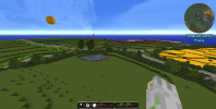
All the brown wool yall see in this picture is where I wish to kind of expand the woods. There is another thread recently made talking about how the Kingswood should be dealt with, and I'd like to see some input on that here too.


