Just wanted to say that this feedback has been really helpful, you're put in so much effort into it and I really appreciate it 
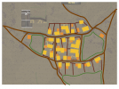
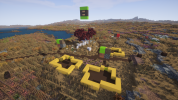
I've mostly implemented the larger shortcuts, however I'm still working on the south to west path as I'm not completely happy with it's shape. I've plotted down a majority of the houses, but I'm definitely still working on the centre bit between the major roads. I've been working on that kind of bundle/collection of houses but I still want stand alone houses on the edges of the village. I also added a lot of workspaces, sheds and covered areas (in orange).
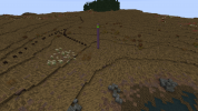
The rural paths are definitely still in their infancy, very rough plans just so I know where they'll generally go. I didn't even think about that aspect of how paths actually come to be. When I put them in their permanent place, I'll be sure to include the roads kinda looping back on them selves as well as crawling up the hills like you said. Once again, thank you, all you've done has been a massive help.
Also here's a really rough concept I made on google drawings while bored at university


