hmm its about time....
Past Projects-
Amberly
Grandison Crossing
A peasbury hamlet
-Canon-
House Shermer are a noble house from Smithyton, in the reach. Semi-canon states their sigil is blue with a field of copper nails and a copper border.
During a clash of kings, they declare for Renly Baratheon during the war of the five kings.
What this tells me:
Smithyton is a town, hence, ton. (lol)
They like smithy-ing.
They like copper.
How I tend to implement this:
Make a town.
Make a mine for copper.
Make a few smithies and a smithies guild within a tithe barn.
-Inspiration & Plans-
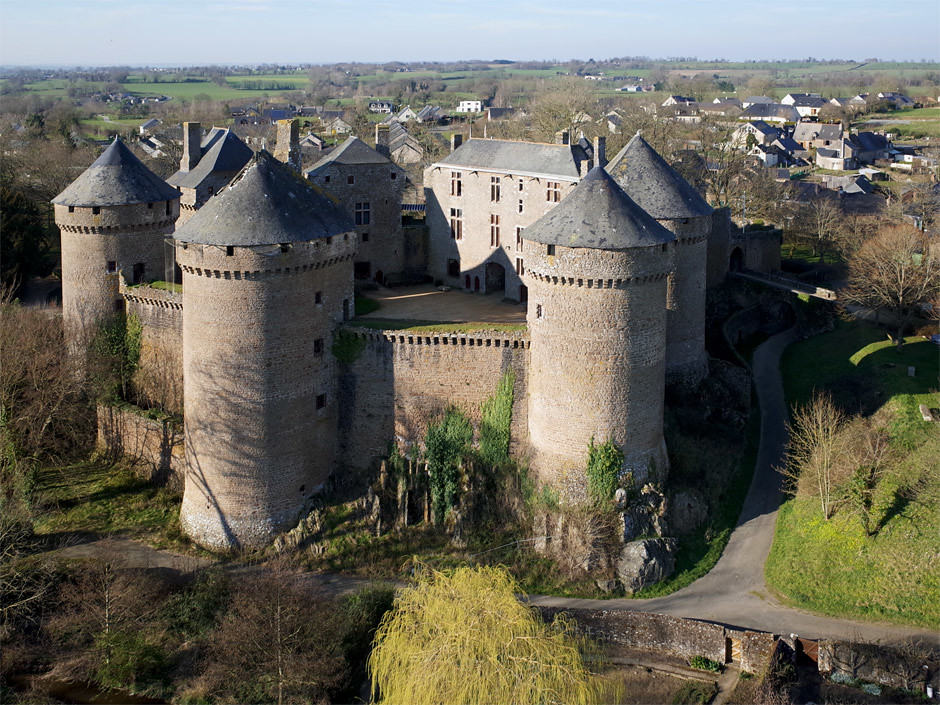
Castle- Lassay Les Chateux. This is a french castle that still has some english style plain, strong looking features- this makes a good transition inspiration from the english style crownlands to the french style reach.


(Front- towerhouse + war planning conference room thingy
two towers to the side of it- Barracks and servants
Top- Main keep
all other towers- Kitchens, guests, etc.)
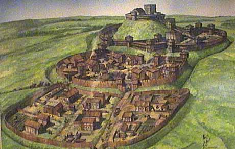
The town- I have based the layout primarily off a french motte and bailey town illustration, which depicts a town situated on a hill, with drymoats dug into the hill, giving the impression of a big motte. There are different levels to the mottes as they progress higher up the hill with the keep at the top.
It will also have a river to the side of it serving as a natural fortification with a mill.
It will hold approx. 25 houses, a tithe barn, a sept, and an inn outside the walls.


(Town walls will not be very tall as the slopes of the drymoats with serve as fortification)
Houses-


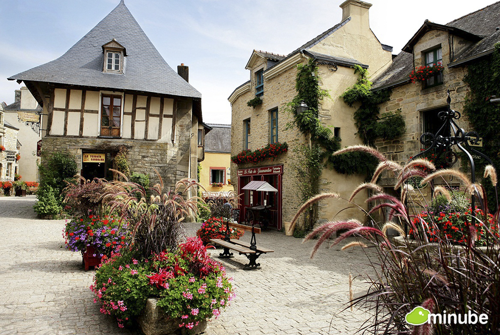
As you can see here the houses are relatively modest as smithyton is not a large or super influential place but not in complete shambles as the reach is known for being rather classy.
The witewash houses on the left hand side will only be used in rural hamlets.
The slate colours reflect the house colours rather nicely and is not too dissimilar from risleys.
Tithe barn-


The lands-

This is a modified version of a map iwan gave me of his terraforming plans.
I added the (Purple) villages and white roads.
Red- Roads
Green- Forest
Blue- Rivers
Yellow- Farmland (Which I intend to make using geometric stone walls with rectangles of veggies and such similar to that at winterfel)
I realise this map may overlap Potts risely somewhat but after consultation with Iwan he recommended I just post the app and figure things out here.
I think thats it, thanks!
Past Projects-
Amberly
Grandison Crossing
A peasbury hamlet
-Canon-
House Shermer are a noble house from Smithyton, in the reach. Semi-canon states their sigil is blue with a field of copper nails and a copper border.
During a clash of kings, they declare for Renly Baratheon during the war of the five kings.
What this tells me:
Smithyton is a town, hence, ton. (lol)
They like smithy-ing.
They like copper.
How I tend to implement this:
Make a town.
Make a mine for copper.
Make a few smithies and a smithies guild within a tithe barn.
-Inspiration & Plans-
Castle- Lassay Les Chateux. This is a french castle that still has some english style plain, strong looking features- this makes a good transition inspiration from the english style crownlands to the french style reach.


(Front- towerhouse + war planning conference room thingy
two towers to the side of it- Barracks and servants
Top- Main keep
all other towers- Kitchens, guests, etc.)
The town- I have based the layout primarily off a french motte and bailey town illustration, which depicts a town situated on a hill, with drymoats dug into the hill, giving the impression of a big motte. There are different levels to the mottes as they progress higher up the hill with the keep at the top.
It will also have a river to the side of it serving as a natural fortification with a mill.
It will hold approx. 25 houses, a tithe barn, a sept, and an inn outside the walls.


(Town walls will not be very tall as the slopes of the drymoats with serve as fortification)
Houses-


As you can see here the houses are relatively modest as smithyton is not a large or super influential place but not in complete shambles as the reach is known for being rather classy.
The witewash houses on the left hand side will only be used in rural hamlets.
The slate colours reflect the house colours rather nicely and is not too dissimilar from risleys.
Tithe barn-


The lands-

This is a modified version of a map iwan gave me of his terraforming plans.
I added the (Purple) villages and white roads.
Red- Roads
Green- Forest
Blue- Rivers
Yellow- Farmland (Which I intend to make using geometric stone walls with rectangles of veggies and such similar to that at winterfel)
I realise this map may overlap Potts risely somewhat but after consultation with Iwan he recommended I just post the app and figure things out here.
I think thats it, thanks!
Last edited by a moderator:


