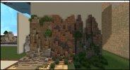
Agreed, I like the result. Just please update the worldpainter terrain before making the changes, I know I’ve been helping a little but I don’t think I’ve got enough time to do that mountain section to the south, and even then I haven’t been steaming ahead on it. I know what I want to do though
Dornish Marches Terra
- Thread starter CashBanks
- Start date
-
The Spring 2023 edition of The Rookery is now out! Take a look to see the latest builds, guides, progress and development updates on the upcoming 1.18.2 switch. You can read it here:
https://indd.adobe.com/view/f943da18-ed77-4d55-845d-fee9bfa14247
You are using an out of date browser. It may not display this or other websites correctly.
You should upgrade or use an alternative browser.
You should upgrade or use an alternative browser.
Having circled back to Dornish Marches terra while helping with Lonmouth I'm reassessing the striation/layers approach to the mountains. On the one hand, they have a somewhat dynamic/contrasty style to them that's fairly unique, on the other:
- They're hard to replicate without the exact script I used and an extensive amount of manual layering
- I'm not sure how realistic they look (like it's hard to point to any large scale mountain ranges with a similar layering style.)
- The new CTM blending of the old stormlands terrain set with alt terrain makes almost doubles its width makning it more pronounced than the original tests.
I'm wondering if we should pivot to a more simplified rock mix, with a random smattering of Grey Sandstone and Dry Stormlands pebbles.
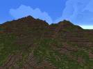
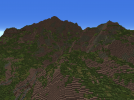
Current vs New style
The sandstone/pebbles mix in fairly subtly and I think it's an effect that's more easily replicable for builders on future projects.
To get the large sandstone blobs I used /br rock 2317:5 20 90 89 98 and /br rock 2246:9 5 90 89 98 for the pebbles with a 2317:3 mask.
If we like this direction I'm fine to start work on redoing the mountains that have the strata lines.
- They're hard to replicate without the exact script I used and an extensive amount of manual layering
- I'm not sure how realistic they look (like it's hard to point to any large scale mountain ranges with a similar layering style.)
- The new CTM blending of the old stormlands terrain set with alt terrain makes almost doubles its width makning it more pronounced than the original tests.
I'm wondering if we should pivot to a more simplified rock mix, with a random smattering of Grey Sandstone and Dry Stormlands pebbles.


Current vs New style
The sandstone/pebbles mix in fairly subtly and I think it's an effect that's more easily replicable for builders on future projects.
To get the large sandstone blobs I used /br rock 2317:5 20 90 89 98 and /br rock 2246:9 5 90 89 98 for the pebbles with a 2317:3 mask.
If we like this direction I'm fine to start work on redoing the mountains that have the strata lines.
I much prefer the old style, it looks more realistic and adds more contrast (though it also has its flaws visually)
Personally I dislike large patches of just one terrainset, it looks bland and unrealistic to me.
Personally I dislike large patches of just one terrainset, it looks bland and unrealistic to me.
I'm a fan of the new version for large areas, though the old way could definitely be used in small areas as desired by the project lead, similar to how terrainset stairs and slabs aren't used on every single mountainside. This would mean more attention to how the striations are tipped or not as well as their visual appeal.
I like the new style but would add maybe smaller Lines of Brown Terrainset for Contrast maybe something grey like North Terrain set ? I have to test it First but a Bit Contrast would be cool for me
My two cents: I'm pro new style. No more tiger stripes on mountains, please.
To this point, there are some mountain ranges IRL that have very distinct horizontal layering pattern, such as the Maharashtra range in India, so it's not entirely out of the picture (though I can't attest to whether this is appropriate for the geology of the Stormlands).- I'm not sure how realistic they look (like it's hard to point to any large scale mountain ranges with a similar layering style.)
Examples:
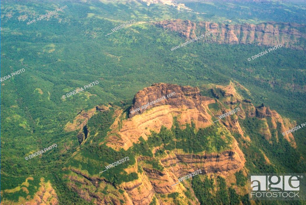
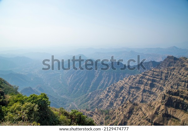
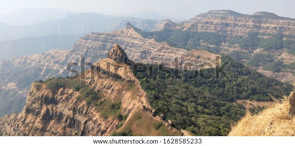
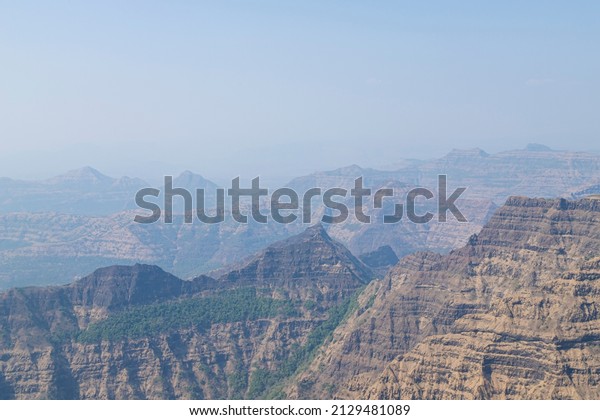
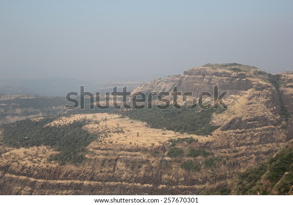
That said, I agree that there's something off about it currently. Something to note in the example images is that the bands are actually a bit wider, but also a bit more variable, and with a lot more visible terracing/vegetation. It also seems like the contrast between Stormlands and Alt Stormlands is just a bit too harsh; the striations in the example images seem a bit more subtle and "dusty". This begs the question of whether the main Stormlands terrainset should be made lighter and less saturated (if it doesn't mess up other uses), or if an in-between terrainset should be added. This might help make the terrainset more useable and avoid bland terrainset patches, regardless of whether we go with horizontal bands or a different pattern.
Point being, I think a different style could work, but let's not be too quick to discount a horizontal layering style as an option if there's ways it might be improved through different technique or texture changes.
To this point, there are some mountain ranges IRL that have very distinct horizontal layering pattern, such as the Maharashtra range in India, so it's not entirely out of the picture (though I can't attest to whether this is appropriate for the geology of the Stormlands).
Well, the Deccan Plateau, specifically the Deccan Traps, have a very specific geological history, as far as I know. It is theorised that a series of really strong and continous lava flows generated its characteristic striations. Eruptions that took place on a relatively short period of time (300.000 years to a few million years) and around 67 to 63 million years ago. The result was a vast series of basalt (igneous rock that forms on surface level) and granite (igneous rock that forms under compression) highlands shaped mainly by erosion and, to some degree, orogeny. The landscape, due to the rock type and the layering, features a series of step-like hillsides, as well as rounded slopes and flat tops, for the most part.
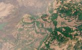
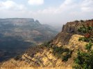
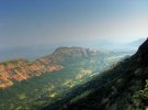
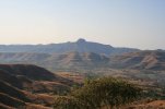
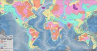
The Deccan Traps are that big purple patch in the middle of India
IMO the Red Mountains seem to be the result of a more traditional orogeny (like the Alps, the Himalayas or the Andes, all younger than the Deccan Traps), something that at least would've shifted the direction of the layers, if not break them.That been said, I dont see why we wouldn't be able to implement something like this on some areas of the Stormlands. I personally see the region as having some kind of notable volcanic activity (past and/or present), been close-ish to the known active volcanoes (Dragonstone) and having mentions of black basalt castles (rock that is the main one in the Deccan). On that same line, I can see extint volcanoes like the ones in Olot as an interesting feature of the region.
I think it is worth metioning that, accidentally or not, Lonmouth and other projects like Felwood have incorporated into their terrain features that resemble some of those seen at the Deccan.
TO SUM UP: Yes, the pattern is realistic, but it requires a series of specific geological events that would've shaped the landscape on quite a specific way. It is on us to decide if we go that route and to what extent. Also I'm not a geologist, so my knowledge is limited to non-academic publications and documentaries I saw on the area.
at least in my area of the alps, most stone has a striped pattern (tho rarely such a strong contrast, but still quite clearly visible) and with broader bands usually
quite a nice example of the huge bands of stone bending and forming mountains is at the Walensee in Switzerland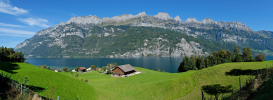
sadly you cant really see the wonderful huge U-turn the layers makes at the west end (to the left of the image), i hope i can get a good picture the next time i drive by in the train
i get many dont like the dark stormlands terrainset, maybe try a pattern with less of a contrast? still to me not having those stripes kinda looks wrong
quite a nice example of the huge bands of stone bending and forming mountains is at the Walensee in Switzerland

sadly you cant really see the wonderful huge U-turn the layers makes at the west end (to the left of the image), i hope i can get a good picture the next time i drive by in the train
i get many dont like the dark stormlands terrainset, maybe try a pattern with less of a contrast? still to me not having those stripes kinda looks wrong
Well the main difference is that those stripes, unlike the ones at the Deccan or currently at the West of the Stormlands, bend themselves showing how the tectonic forces shaped the mountains. We could implement that, but it would be much more involved and imply more work and being more thoughtful with its placement to properly show how those stripes bend and erode. Also, notice that the stripes are highlited by the shape of the moutain, the erosions patterns and the way vegetation grows (more on some layers than others, due to soil composition and/or flatter ground due to different erosion speeds). We currently don't have that, for the most part.
In most mountain ranges one can see the striation lines, it is very common. What is uncommon is the current distribution of strictly horizontal lines (you can also see it in deserts or arid climates, where erosion in quaternary deposits is strong, but that wouldn't be the case in the Stormlands).
In most mountain ranges one can see the striation lines, it is very common. What is uncommon is the current distribution of strictly horizontal lines (you can also see it in deserts or arid climates, where erosion in quaternary deposits is strong, but that wouldn't be the case in the Stormlands).
Thanks everyone, I'll work with these ideas to come up with some different options, either more varied/wavy striation lines that show how the mountains were pushed up out of the ground (rather than exposed via erosion/igneous rock flows), or a more of a composite mix like in this test.
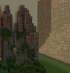
Either way I think shifting away from the flat horizontal lines will be the way to go.

Either way I think shifting away from the flat horizontal lines will be the way to go.
true, but at least simple horizontal lines are more than nothing (and most lines in mountains are roughly horizontal, them bending in weird shapes is rare)Well the main difference is that those stripes, unlike the ones at the Deccan or currently at the West of the Stormlands, bend themselves showing how the tectonic forces shaped the mountains. We could implement that, but it would be much more involved and imply more work and being more thoughtful with its placement to properly show how those stripes bend and erode. Also, notice that the stripes are highlited by the shape of the moutain, the erosions patterns and the way vegetation grows (more on some layers than others, due to soil composition and/or flatter ground due to different erosion speeds). We currently don't have that, for the most part.
In most mountain ranges one can see the striation lines, it is very common. What is uncommon is the current distribution of strictly horizontal lines (you can also see it in deserts or arid climates, where erosion in quaternary deposits is strong, but that wouldn't be the case in the Stormlands).
I'd love it of course to have the lines bend more and show more detail, but that seems to be a lot of work, so to me having simpler horizontal lines is a compromise that is better than have no lines at all.
For me, having just one terrainset looks uninteresting, and adding some patches of other terrainsets doesnt really help.
To be clear, I dont know much at all about terraforming, and dont really understand the difficulties associated with forming mountains. That being said, as someone that greatly appreciates well made mountains, I think putting in the extra effort to make them realistic and good looking is absolutely worth it.
I get that people don't want to pour too much of their time into the landscape, still the overall project suffers from unrealistic and bland mountainranges.
Last edited:
All layers in rock are by default horizontal - because sediment or ash is deposited horizontally. The 'bending' (folding) occurs after chronologically, and in some cases can be crazy - like the instances where you get vertical layers of rock. Deformation/folding occurs due to tectonic movement typically. Most mountains form at convergent boundaries in orogenic belts, so you will see crazy folding a lot of the time (and typically reverse faulting as well), like in the alps among other places. This isn't to say you can't get perfectly horizontal layering in mts, you can, but typically it'll be deformed in some fashion and you'll get anticlines and synclines across the range, not to mention areas of metamorphosed rock, plutons, etc.
Also yeah any layers done should be reflected in the terrain itself otherwise it looks a bit weird/unnatural.
Also yeah any layers done should be reflected in the terrain itself otherwise it looks a bit weird/unnatural.
Yeah I get the impression you only see straight horizontal lines of striation when the rock layers are exposed by erosion, like in the pic of Grand Canyon below.
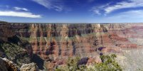
If the mountains have been thrust up by plate tectonics, as the Red Mountains most likely were, these lines become warped and wavy.
The striation lines currently on the mountains were basically a compromise to get the job done with a an automated script, there’s definitely room for improvement

If the mountains have been thrust up by plate tectonics, as the Red Mountains most likely were, these lines become warped and wavy.
The striation lines currently on the mountains were basically a compromise to get the job done with a an automated script, there’s definitely room for improvement
Cash if u need Help with the Tera in the Red Moutnains i feel free to help u! just let me know ur plans and give me smaller tasks because this Mountain Grandite is the last task in Lonmouth so let me know i also test around the hole time with Other Grey Terrain blocks as Contrast.
love you <3Well, the Deccan Plateau, specifically the Deccan Traps, have a very specific geological history, as far as I know. It is theorised that a series of really strong and continous lava flows generated its characteristic striations. Eruptions that took place on a relatively short period of time (300.000 years to a few million years) and around 67 to 63 million years ago. The result was a vast series of basalt (igneous rock that forms on surface level) and granite (igneous rock that forms under compression) highlands shaped mainly by erosion and, to some degree, orogeny. The landscape, due to the rock type and the layering, features a series of step-like hillsides, as well as rounded slopes and flat tops, for the most part.
View attachment 12473View attachment 12472View attachment 12470View attachment 12469
View attachment 12471
The Deccan Traps are that big purple patch in the middle of India
IMO the Red Mountains seem to be the result of a more traditional orogeny (like the Alps, the Himalayas or the Andes, all younger than the Deccan Traps), something that at least would've shifted the direction of the layers, if not break them.That been said, I dont see why we wouldn't be able to implement something like this on some areas of the Stormlands. I personally see the region as having some kind of notable volcanic activity (past and/or present), been close-ish to the known active volcanoes (Dragonstone) and having mentions of black basalt castles (rock that is the main one in the Deccan). On that same line, I can see extint volcanoes like the ones in Olot as an interesting feature of the region.
I think it is worth metioning that, accidentally or not, Lonmouth and other projects like Felwood have incorporated into their terrain features that resemble some of those seen at the Deccan.
TO SUM UP: Yes, the pattern is realistic, but it requires a series of specific geological events that would've shaped the landscape on quite a specific way. It is on us to decide if we go that route and to what extent. Also I'm not a geologist, so my knowledge is limited to non-academic publications and documentaries I saw on the area.
How did you get the real narrow strips of the darker brown CTM? Did you place slabs above it? I might have to "steal" that idea.View attachment 12465
I love how the gradient is done in the right, a simplified version of it could be really nice.
I feel I don't have much of value to share about this but I would like to see us move away from this really harsh reddish brown ts in the stormlands red mountains. It just.. feels wrong for the type of mountains we've been going for in the region, I dont see what real life equivalent the server is replicating by using this style of ts in mountains likely more akin to the alps or the caucuses than... whatever this ts would be best suited for. As far as im concerned, though really i feel my opinion on terra in general shouldnt be held to the highest regard, it would both make more sense and be more visually compelling if we made the ts for the mountains more typical to the regions we're trying to replicate.
Share:


