Hey (soon to be) neighbour!
I'm currently working with
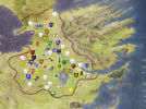
Jakethesnake8_8 to transform the vast open swamp between Ramsford, Mandrake and FMseptry to a combination of heath, forest and floodplains in the near future. The goal is to create a wilderness that will create a natural border between projects without turning the area into a second Neck. We could enlarge this area to reach all the way to the Green Fork, encompassing most of the area you dedicated to forest on the border with Fairmarket and Vypren in your app.
Wildernesses like these are historically used for a wide variety of uses, including hunting, grazing and peat extraction. During the middle ages many of these heaths were subject to sand drifts, a result from soil erosion from overgrazing and -farming, as well as extensive logging. We're not sure wether to include sand drifts though.
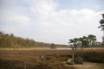
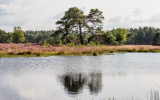
For the terrain I intend to rely mostly on the Veluwe and Utrechtse Heuvelrug in the Netherlands for inspiration. Here are some vibes:
View attachment 14128
View attachment 14129
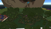
View attachment 14130
Let me know if you want to join in!
I also have some feedback for the app:
- I think the scale of your map is slightly off. Using either the hamlet north of the FMseptry or at Vypren castle as reference, the space between the three hamlets and the main town is not enough. I recommend removing the eastern hamlet since it's fairly close to the Vypren one, and maybe even the western one as well since it's kind of awkwardly situated on a slope and close enough to both your castle and the Hags Mire hamlet in order to break up the forest around it and remove the illusion of it being isolated. That would also give you room to move the remaining hamlet upriver, so it isn't right across the castle at Haigh.
- The stream you added is situated on a slope between a low ridge the majority of Mandrake is on and the marshland at Sevenstreams. I recommend not lowering the terrain any further since we need the ridge to prevent the Green Fork from barging into the low lying wetlands and the Blue Fork much earlier than it does. With the current terrain at Mandrake the hydrology on the south and west side is mostly solved already, so there is no need to add streams or rivers on this side.
- There is a road from Vypren that will stop at the border of the lands in the current plans.
- What is the plan for the riverbank of the Green Fork?


