Heya, I figured my next post would be about glaciers and how they work and some of the unique forms they leave behind! Here we go,
A glacier is a large dense mass of ice that is *always moving*. Whether they are descending the mountain due to gravity acting on their own weight, or melting and shrinking, a glacier is always on the move. They form when fallen snow gets compressed over very long periods of time (usually centuries). As a result, they are only really found at high altitudes where snow is present year-round.
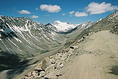
Glacial valleys are characterised by U-shaped valleys. This is in contrast to river valleys, which typically have V-shaped valleys. This is because of the shape of glaciers, and how they interact with the valley walls and floor. Stones are plucked from the side of the valley wall. This happens when meltwater seeps into the cracks in rocks, freezes and melts, expanding the cracks until separation occurs. Eventually, the rocks move with the ice. At the bottom of the valley, we see a process called abrasion occuring. When rocks at the bottom of a glacier grind against the bedrock of the mountain when the glacier moves, it creates a smooth, often striated surface. Debris that falls onto the glacier from the bordering rock walls create what's called lateral moraines. They end up making smooth and defined lines of rock in the glacier. They typically form at the edge of a glacier, or if two glaciers meet because the ridge dividing them terminates.


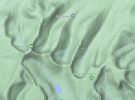
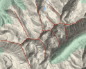
Typically in glacial valleys, we see the standard alternating ridgeline, where you have on one side of the dividing range a valley and on the other side in the same location you will have a ridge. Below are some examples of this.


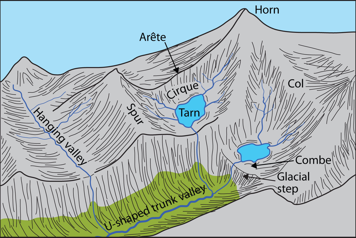
The image on the left is from the Brecon Beacons, referring to a mountain range of old red sandstone peaks in the south of Wales. While glaciers are no longer present here, there is clear evidence of glacial action by the U-shaped valleys, both in horizontal and vertical profile. These depressions between ridges are called "cirques". They are U-shaped depressions that form at higher elevations in mountains. Similar alternating cirques and ridges can be seen in the image on the right, from the Canadian Rockies. The rocky mountains have quite a bit more elevation to them than the Brecon Beacons, so you can see a bit more how cirques fit into the overall picture of a glacial valley. You can also see how the cirques abruptly stop and there's a significant decrease in altitude once they get to the middle of the valley. This is because in the main trough, a larger, deeper glacier once resided, and the smaller glaciers that occupied/occupy the cirques merely merged with the larger glacier. As a result, they never carved as low as the main valley, and create an image of a valley being suspended high above the floor.

An Arête is a steep ridge that is being eroded by two parallel glaciers. When two glaciers erode perpendicular to the ridge, it results in what's called a col. Col are low points in a ridge between two peaks that acts as a mountain pass.
In glacial landforms, a horn is a mountain peak being eroded by *at least* 3 glaciers. They typically have a flat rock face, and are pyramidal. An example of this would be the Matterhorn. It's worth mentioning that rock density can play a role in what sort of forms are present.
For example, a layer of soft rock would erode fast, and create very defined ridges and gullies. In contrast to harder rock types, which would be more rounded and have fewer, less deep gullies. Similarly, because you're more likely to find active glaciers close to mountain peaks, at the highest altitudes, you can expect more active erosion (rockfalls, terracing, plucking etc) than at the bottom of a valley, which has been smoothed by mostly wind and rain abrasion when there used to be a glacier there.
Crevasses are cracks in glaciers caused by stress to the ice. They come in various forms, outlined below.
When glaciers melt, they often leave behind boulders that have been carried with the ice for sometimes miles. These are called glacial erratics, and are usually a different type of rock compared to the native rock where it gets deposited.
Where glaciers end, they deposit a terminal moraine. This is all of the glacial till and rocks they've pushed from higher elevations. Often once the glacier has melted, a lake sometimes forms here. Eventually, the lake will break down the moraine, and stream(s) will flow from it into the outwash plain, an open area where glacial till has been deposited. Sometimes, however, glaciers don't make it to lower altitudes, and meltwater becomes mountain streams, which creates V-shaped river valleys further down the mountain.
Some places on the server that would most likely have active glaciers would be the Frostfangs, The Clan Mountains in the North, the Vale (The Fingers in particular point to fjords as their formation). Former glacial action would likely have been seen in the Red mountains, both Reach and Stormlands sections.
A lot of this is obsessive research I have done in my free time, and it is by no means professional or to be taken as gospel, but hopefully you are now all well-informed of how glacial mountains work.
A glacier is a large dense mass of ice that is *always moving*. Whether they are descending the mountain due to gravity acting on their own weight, or melting and shrinking, a glacier is always on the move. They form when fallen snow gets compressed over very long periods of time (usually centuries). As a result, they are only really found at high altitudes where snow is present year-round.
Glacial valleys are characterised by U-shaped valleys. This is in contrast to river valleys, which typically have V-shaped valleys. This is because of the shape of glaciers, and how they interact with the valley walls and floor. Stones are plucked from the side of the valley wall. This happens when meltwater seeps into the cracks in rocks, freezes and melts, expanding the cracks until separation occurs. Eventually, the rocks move with the ice. At the bottom of the valley, we see a process called abrasion occuring. When rocks at the bottom of a glacier grind against the bedrock of the mountain when the glacier moves, it creates a smooth, often striated surface. Debris that falls onto the glacier from the bordering rock walls create what's called lateral moraines. They end up making smooth and defined lines of rock in the glacier. They typically form at the edge of a glacier, or if two glaciers meet because the ridge dividing them terminates.


Typically in glacial valleys, we see the standard alternating ridgeline, where you have on one side of the dividing range a valley and on the other side in the same location you will have a ridge. Below are some examples of this.


The image on the left is from the Brecon Beacons, referring to a mountain range of old red sandstone peaks in the south of Wales. While glaciers are no longer present here, there is clear evidence of glacial action by the U-shaped valleys, both in horizontal and vertical profile. These depressions between ridges are called "cirques". They are U-shaped depressions that form at higher elevations in mountains. Similar alternating cirques and ridges can be seen in the image on the right, from the Canadian Rockies. The rocky mountains have quite a bit more elevation to them than the Brecon Beacons, so you can see a bit more how cirques fit into the overall picture of a glacial valley. You can also see how the cirques abruptly stop and there's a significant decrease in altitude once they get to the middle of the valley. This is because in the main trough, a larger, deeper glacier once resided, and the smaller glaciers that occupied/occupy the cirques merely merged with the larger glacier. As a result, they never carved as low as the main valley, and create an image of a valley being suspended high above the floor.

An Arête is a steep ridge that is being eroded by two parallel glaciers. When two glaciers erode perpendicular to the ridge, it results in what's called a col. Col are low points in a ridge between two peaks that acts as a mountain pass.
In glacial landforms, a horn is a mountain peak being eroded by *at least* 3 glaciers. They typically have a flat rock face, and are pyramidal. An example of this would be the Matterhorn. It's worth mentioning that rock density can play a role in what sort of forms are present.
For example, a layer of soft rock would erode fast, and create very defined ridges and gullies. In contrast to harder rock types, which would be more rounded and have fewer, less deep gullies. Similarly, because you're more likely to find active glaciers close to mountain peaks, at the highest altitudes, you can expect more active erosion (rockfalls, terracing, plucking etc) than at the bottom of a valley, which has been smoothed by mostly wind and rain abrasion when there used to be a glacier there.
Crevasses are cracks in glaciers caused by stress to the ice. They come in various forms, outlined below.
When glaciers melt, they often leave behind boulders that have been carried with the ice for sometimes miles. These are called glacial erratics, and are usually a different type of rock compared to the native rock where it gets deposited.
Where glaciers end, they deposit a terminal moraine. This is all of the glacial till and rocks they've pushed from higher elevations. Often once the glacier has melted, a lake sometimes forms here. Eventually, the lake will break down the moraine, and stream(s) will flow from it into the outwash plain, an open area where glacial till has been deposited. Sometimes, however, glaciers don't make it to lower altitudes, and meltwater becomes mountain streams, which creates V-shaped river valleys further down the mountain.
Some places on the server that would most likely have active glaciers would be the Frostfangs, The Clan Mountains in the North, the Vale (The Fingers in particular point to fjords as their formation). Former glacial action would likely have been seen in the Red mountains, both Reach and Stormlands sections.
A lot of this is obsessive research I have done in my free time, and it is by no means professional or to be taken as gospel, but hopefully you are now all well-informed of how glacial mountains work.
Last edited:


