- Pronouns
- he/him


[Note] This Thread is under construction, but can already help builders planning projects a lot. The parts about "Professions" and about "Layouts" are mostly done.
This thread is about: Finding fitting locations for larger villages and towns, defining its size and distribution of professions, planning realistic layouts as well as the surroundings of the place.
This thread is not about: Architecture and Building.
Location
Coming soon...
Size
While this section is not done yet, size of towns depend on these factors:
More soon...
Professions
Please always check out this document.
As you can see, towns had to be quite large to support a profession. This is because in pre-industrialized times the yield of farming was so small, you can roughly say 140 farmers had to support 1 not-farmer.
Obviously we cannot build houses for 150 farmers in a town to build one for a shoemaker. But we should always try to show that the vast majority of people in this time were peasants.
With growing size of a settlement the proportion of professions towards farmers does increase, since they will be forced out of a towns boundaries by larger distances and higher prices (given a town with town citizen that were actually able to acess the market freely). As you can see in cities like Kings Landing and White Harbour, most peasants would settle outside the walls or in sub centres (villages, smaller towns in proximity to the regional centre). This applies to towns of the size of Bitterbridge, Fairmarket, Duskendale and larger (in our measures, 150 houses+). Even towns of the size of Bandallon (in our measures, 80 houses) have more farmers than other professions.
Lets start an example for a distribution of professions following Whitefireneo's profession document:
Roughly 500 inhabitants, leading to:
Some of those can be:
Layout
Villages
This is an overview of the most common types of village layouts in europe during the medieval times. Layouts were mostly defined my geographical features like terrain or rivers, but also greatly by existing roads and culture.

Layouts g) and h) show examples of villages along a through road. Whenever you have roads that lead through your project, you should place villages like these along them.
Layout f) (German "Rundling") is a purely agricultural or foresting settlement located at the end of a road. You can place these next to forests or inside a larger portion of fields.
Check out this website for nice maps of medieval villages (Thanks to kulmen).
Towns
Surroundings
Check out this model of a town with "Thünen rings":

More soon..
This thread is about: Finding fitting locations for larger villages and towns, defining its size and distribution of professions, planning realistic layouts as well as the surroundings of the place.
This thread is not about: Architecture and Building.
Location
Coming soon...
Size
While this section is not done yet, size of towns depend on these factors:
- Density of the region
- Food production capability of the surroundings
- Trade Routes
- Since we build GRRM's universe, also by Canon and what he tells us about the wealth of the noble houses.
More soon...
Professions
Please always check out this document.
As you can see, towns had to be quite large to support a profession. This is because in pre-industrialized times the yield of farming was so small, you can roughly say 140 farmers had to support 1 not-farmer.
Obviously we cannot build houses for 150 farmers in a town to build one for a shoemaker. But we should always try to show that the vast majority of people in this time were peasants.
With growing size of a settlement the proportion of professions towards farmers does increase, since they will be forced out of a towns boundaries by larger distances and higher prices (given a town with town citizen that were actually able to acess the market freely). As you can see in cities like Kings Landing and White Harbour, most peasants would settle outside the walls or in sub centres (villages, smaller towns in proximity to the regional centre). This applies to towns of the size of Bitterbridge, Fairmarket, Duskendale and larger (in our measures, 150 houses+). Even towns of the size of Bandallon (in our measures, 80 houses) have more farmers than other professions.
Lets start an example for a distribution of professions following Whitefireneo's profession document:
Roughly 500 inhabitants, leading to:
- 1 Mason
- 1 Pastrycook
- 1 Old-Clothes dealer
- 1 Tavern-keeper
- 1 Jeweler (does not scale down properly to our servers measures, should not be put in smaller towns)
- 1 Cleric
- 1-2 Barbers (Surgeon)
- 2 Tailors
- 2 Maidservants
- 2 Furrier
- 3 Shoemaker
- 484 Farmers
- 1 Mason
- 1 Pastrycook
- 1 Old-Clothes dealer
- 1 Tavern-keeper
- 1 Septon
- 1 Maidservant
- 1 Barber (Surgeon)
- 1 Tailor
- 1-2 Furrier
- 2 Shoemakers
- 18-19 Farmers
Some of those can be:
- Geographical features of the surroundings. A town at the coast has not only farmers for food production, also fishermen. Near larger forests there are also hunters, and a larger amount of citizens working in the wood sector.
- Proximity to larger centres (drain of higher professions) or smaller centres (gain of higher professions).
- Traderoutes. Settlements along the main trade routes of Westeros like the Roseroad, Kings Road, Goldroad etc. can have a significantly larger amount of Inns, Cartwrights, Saddlers, Trading professions; or respecticly can have those professions in towns that would normally not support them.
Layout
Villages
This is an overview of the most common types of village layouts in europe during the medieval times. Layouts were mostly defined my geographical features like terrain or rivers, but also greatly by existing roads and culture.
Layouts g) and h) show examples of villages along a through road. Whenever you have roads that lead through your project, you should place villages like these along them.
Layout f) (German "Rundling") is a purely agricultural or foresting settlement located at the end of a road. You can place these next to forests or inside a larger portion of fields.
Check out this website for nice maps of medieval villages (Thanks to kulmen).
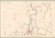
Towns
- This awesome collection of maps, mostly of towns but also of the countryside.
- Check out this book with maps of towns (Thanks Estoop for both).
- For everyone that likes reading, kulmen found this book about the history of towns.
Surroundings
Check out this model of a town with "Thünen rings":
More soon..