KL Plotting Inspiration

Emoticone11

The Dark Lord Sauron
Staff member
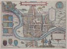
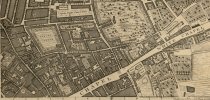
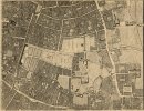
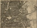
Thanks to Aino , Ric , and Batelgause for sharing some of the following city maps that can help serve as inspiration for plotting your KL districts. While some of them are a bit more modern than the medieval setting we base our server on, they still provide a good idea of how dense city blocks developed in an age before modern construction and transportation.

If anyone has come across any others that are relevant for KL, feel free to share them here!

Chester

1795
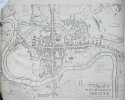
P20435.jpg

1581


Chester Braun Hogenberg.JPG

London 1746


Full map (NOTE: very large filesize)
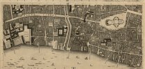
Screenshot_2023-12-30_210303.jpg
Screenshot_2023-12-30_210350.jpgScreenshot_2023-12-30_210641.jpgScreenshot_2023-12-30_210752.jpg

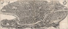
Rome 1652

1652_Merian_Panoramic_View_or_Map_of_Rome_Italy_-_Geographicus_-_Roma-merian-1642.jpg

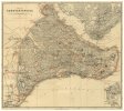
Constantinople 1893

constantinople.jpg


Several other examples here: https://earthlymission.com/maps-of-medieval-cities/
 

EStoop

Knight of Fairmarket
Afaik there is several gigabytes of inspirational pictures, including HD quality maps, on the Westeroscraft google drive.
I tried finding the link but I can't find it anymore, and I've been locked out of the drive about half a decade now so I can't dig it back up.
If these are gone I can put them back up, but I need a space to chuck it on because both of my drives are full (which is why it was on the Westeroscraft drive in the first place).

There is also this map which digitalised the maps of most Dutch cities from ~1575, as well as from ~1650 (you can toggle the layers). Each city has a link to the original map on the website of the Biblioteca Nacional de España.

Then there is Amsterdam in 1597 and Cologne in 1571, both of which are extremely detailed for a map from that time period.
Bonus maps of Amsterdam in 1545-1553, 1625 and 1647. The latter two do a nice job of portraying just how fast a city can grow in 20 years, and combined with the 1597 map how fast it grows in 50 years.
 

Desmera

Poet
Probably the best sources of medieval urbanism/town "appearance" (if you don't examine particular buildings) are chronicles by engravers from the second half of the 15th century. Wolgemut's Nürnberger Chronik and Reuwich's Peregrinatio in Terram Sanctam are the most important, they're not bird's eye view like the ones Stoop sent but just some views on cities you can take inspiration from. I haven't done research about Italy and France yet so I can't say if there are better examples (if I find smth I can send it). Individual artists started to paint vedute backgrounds so when you check œuvre of painters like Konrad Witz, Meister der kleinen Passion or hanseatic Bernt Notke and many others, it can be somehow useful too. And for sure you know not so relevant for KL Dürer's aquarelles. I thought I could make a thread more on topic in the future if you were interested.
 
I stick to EStoop and Desmera,
most used sources should be Central European, i elaborated once in the Wood Timbering Post that Kings Landing falls under the categorie of:
"Central Germany half timbering" (Central European)
What i would avoid is getting to close to roman inspired or roman plotted towns. Thats something beein done around Oldtown and the Arbor and this special city structure should stay in the south.
Good Towns would be Amsterdam, Cologne, Nürnberg, Paris, Munich, Magdeburg, Dinan, Strassbourg, Göttingen, Erfurt, Brügge, in general most of the "Hansecities" like Lübeck/Bremen/Münster/Hamburg (due to important traderoutes very fitting)
 
Last edited:

Finn01

Envoy
What i would avoid is getting to close to roman inspired or roman plotted towns. Thats something beein done around Oldtown and the Arbor and this special city structure should stay in the south.
Good Towns would be Amsterdam, Cologne, Nürnberg, Paris, Munich, Magdeburg, Dinan, Strassbourg, Göttingen, Erfurt, Brügge, in general most of the "Hansecities" like Lübeck/Bremen/Münster/Hamburg (due to important traderoutes very fitting)
A few of these cities were originally Roman
 

Azulejo

Bloodmage
Staff member
One of the best sources of this category is the Civitates Orbis Terrarum, perhaps most complete collection of city views and panoramics (around 600) of the Early Modern Age. It was made to be an addition/apendix to Abraham Ortelius' Theatrum Orbis Terrarum, an atlas compelling maps from all over the world. It was published between 1572 and 1617. Lots of individuals contributed to this work, all under the leadership of Gerog Braun. Franz Hogenberg was one of the main engravers, and this is why frecuently Braun-Hogenberg appears as the author(s) online.​

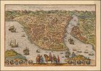
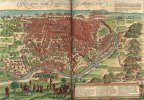
1280px-Braun_&_Hogenberg_-_Byzantium_Nunc_Constantinopolis.jpg
Constantinople/Istanbul

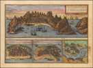
1280px-Ca._1572_view_of_Aden_and_3_other_ports.jpg
Aden (modern day Yemen), Mombasa (modern day Kenya), Kilwa (modern day Tanzania) and Sofala (modern day Mozambique)

Plan_Kaira.jpg
Cairo

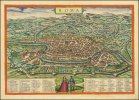
1280px-Braun_&_Hogenberg_-_Roma.jpg
Rome

1280px-Braun_Granada_UBHD.jpg
Granada

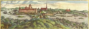
Stockholm-from-north-1570-braun-hogenberg-civitates-orbis-terrarum.jpg
Stockholm

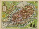
PPN612045943_Hamburgum_(1594).jpg
Hamburg

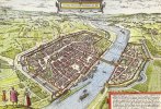
1280px-Frankfurt_Braun-Hogenberg.jpg
Frankfurt

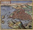
1024px-Marseille_en_1575.jpg
Marseille

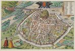
1280px-Braun_Hogenberg_Civitates_orbis_terrarum_Avignon_1575.jpg
Avignon

Sadly either the link or the website I've saved in the past with all the city views categorized broke at some point, but for those interested on it it won't be hard to find alternative sources. Here's a link with the 6 volumes of this work digitalized. Not as useful for King's Landing, but here's an interactive map with all the city views of the Iberian peninsula found within this work. There might be some missing and the categorization could be improved, but here's a link to the Wikimedia Commons.​