Hey doodz! I'm slithering out of my hole to teach you all terra again >
Today's topic - salt marshes. Salt marshes are coastal landforms, formed by the rising and falling of the tides. They are muddy and peat-forming landforms - meaning the ground is spongy and made up of decomposing plant matter. Salt marshes best form in protected coastal areas, with less wave action - for example, in estuaries. Salt marshes are intertidal, meaning part of it is submerged in high tide, and exposed during low tide. This provides excellent habitats for fish, shrimp, crabs and a variety of seabirds. They also help protect coastlines from erosion, with plant roots stabilising the banks and keeping them relatively intact.
https://commons.wikimedia.org/wiki/...e:Salt_pannes_and_pools_high_and_low_tide.gif
https://www.researchgate.net/profil...s-of-saltmarsh-Source-Pye-and-French-1993.ppm
Here's the tutorial on how to make em! This design uses Carc's bog script as a basis, and works off to that to make something similar to a salt marsh test on Gawain's plot, so massive shoutout to those two for being terra junkies.
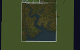
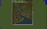
So the first step is to set the ground to 35:13 and the water to 35:11. Then, create defined channels using /b d cc and the arrow tool like so. I go all the way down to /b 1 as the script will make bodies of water slightly smaller than they appear here.
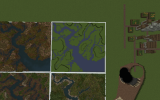
Once you've done that, go around and replace the outer corner of bends in the river with 35:3 using /b d cc again. Also change the smaller feeding channels into 35:3. This will allow an accurate demonstration of sediment being deposited in different sized streams. It's important not to get any 35:3 touching the inside of the bend, otherwise it will look strange. Here's what it should look like.
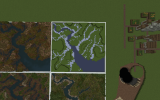
Next, raise the terrain around the channels, to show accurate erosion. Make sure only the top layer of terrain is 35:13, otherwise the script will not work. You can do this by waiting to the end of the preparation work and then doing //replace grass&<[0] 35:13 (if you use grass as your placeholder).
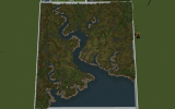
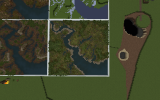
At this point, you're good to run the script! Let me know if there are any errors running this, there may be a few commands that appear to do nothing, but don't worry about them, they're doing what they need to be doing. Here's the finished product!
Thanks for reading !
~ Jake
Today's topic - salt marshes. Salt marshes are coastal landforms, formed by the rising and falling of the tides. They are muddy and peat-forming landforms - meaning the ground is spongy and made up of decomposing plant matter. Salt marshes best form in protected coastal areas, with less wave action - for example, in estuaries. Salt marshes are intertidal, meaning part of it is submerged in high tide, and exposed during low tide. This provides excellent habitats for fish, shrimp, crabs and a variety of seabirds. They also help protect coastlines from erosion, with plant roots stabilising the banks and keeping them relatively intact.
https://commons.wikimedia.org/wiki/...e:Salt_pannes_and_pools_high_and_low_tide.gif
https://www.researchgate.net/profil...s-of-saltmarsh-Source-Pye-and-French-1993.ppm
Here's the tutorial on how to make em! This design uses Carc's bog script as a basis, and works off to that to make something similar to a salt marsh test on Gawain's plot, so massive shoutout to those two for being terra junkies.
So the first step is to set the ground to 35:13 and the water to 35:11. Then, create defined channels using /b d cc and the arrow tool like so. I go all the way down to /b 1 as the script will make bodies of water slightly smaller than they appear here.

Once you've done that, go around and replace the outer corner of bends in the river with 35:3 using /b d cc again. Also change the smaller feeding channels into 35:3. This will allow an accurate demonstration of sediment being deposited in different sized streams. It's important not to get any 35:3 touching the inside of the bend, otherwise it will look strange. Here's what it should look like.

Next, raise the terrain around the channels, to show accurate erosion. Make sure only the top layer of terrain is 35:13, otherwise the script will not work. You can do this by waiting to the end of the preparation work and then doing //replace grass&<[0] 35:13 (if you use grass as your placeholder).
At this point, you're good to run the script! Let me know if there are any errors running this, there may be a few commands that appear to do nothing, but don't worry about them, they're doing what they need to be doing. Here's the finished product!

Thanks for reading !
~ Jake
Attachments
Last edited:


